
LOLA PDS Data Node
This website contains the LOLA PDS Archive, the LRO Radio Science Archive, and links to the NASA/GSFC Planetary Geodesy Data Archive, PGDA.
There is a separate page highlighting the GRAIL data products archived at the PDS.
LOLA PDS Data Node
This website contains and archive of the data obtained by the Lunar Orbiter Laser Altimeter (LOLA), an instrument onboard the NASA Lunar Reconnaissance Orbiter (LRO) mission. It also hosts higher-level products, all to the standards of the Planetary Data System (PDS).
NEW: We have derived new high-resolution DEMs of many regions surrounding high-priority lunar south pole landing sites using laser altimetry data acquired by LRO-LOLA. There is also a larger 5m/px DEM covering 87-90 degrees South.
Note: If you are familiar with the LOLA archive and/or the PDS, you may want to access the archive directory structure directly:
BROWSE
        LOLA_RDR     LOLA_GDR
        SLDEM2015 SLDEM2015_SLOPE    SLDEM2015_AZIMUTH
       Polar_illumination surface_roughness_(2011)
CALIB
CATALOG
DATA:      raw (EDR), profiles (RDR), maps (GDR);
           SLDEM2015 including slope; azimuth;
           active (RADR) and passive (PRADR) radiometry
DOCUMENT
EXTRAS:
          polar illumination, surface roughness

INDEX
LABEL
SOFTWARE
ERRATA.TXT
The 2018/03 release added archive data for the passive radiometry and for surface slope and azimuth. The LOLA archive consists of documentation related to the instrument operations, the various processing levels, and the specific formats used in the archive. Software to read the geolocated altimetric profiles is also available.
The raw data collected by LOLA are available as binary Experimental Data Records (EDRs), for each of the 40,000+ orbits.
Using the best-available ancillary information (geodetic position and calibration data), these are geolocated into binary elevation profiles (Reduced Data Records, or RDRs).
The primary higher-level LOLA products are shape models of the lunar surface in the form of Gridded Data Records (GDRs), in binary IMG format and as GeoJPEG2000 (easily importable in GIS software). Both global cylindrical maps and polar stereographic maps are available at several spatial resolutions.
A combination of the LOLA data with the Kaguya Terrain Camera stereo data was performed and resulted in the SLDEM2015 shape model, a map in cylindrical projection with better than 60 m/pixel resolution over the lunar surface.
Additional data products are available, related to polar illumination conditions, geoid height, and surface roughness.
LRO Radio Science Archive
This website also contains the LRO Radio Science archive, with:
- the raw S-band radio tracking data acquired by ground stations (NASA White Sands station, commercial USN stations)
- the one-way ranging data acquired by the LRO Laser Ranging experiment (optical link between ground stations and LRO, collected by the LOLA instrument)
- the ancillary data (weather, maneuvers)
- the LRO science orbits reconstructed by the LOLA team using the radio tracking data, and leveraging the recent GRAIL lunar gravity field solutions.
Supporting documentation on the file formats and conventions and the experiment are also available.
The archive directory structure is accessible directly below:
CATALOG
DATA: tracking data (TRK), 1-way laser ranging (RANGE),
      ancillary data (WEA, SFF),
      reconstructed orbits (SPK)
DOCUMENT
LABEL
AAREADME.TXT
ERRATA.TXT
VOLDESC.CAT
![]()
Planetary Geodesy Data Archive
The Planetary Geodesy Data Archive (PGDA) is an independent data repository for the NASA GSFC Planetary Geology, Geophysics, and Geochemistry Laboratory.
More information is available on specific products, such as:
- adjusted high-resolution 5m/px LOLA DEMs of many lunar south pole regions of interest for science and exploration (including slope maps, error maps, point cloud, clones)
- adjusted high-resolution 5m/px LOLA DEM covering 87-90 degrees South
- the SLDEM2015 global shape model
- the LRO Laser Ranging data acquired by LOLA
- the LRO orbits reconstructed by the LOLA team
- the passive radiometry data
- the slope and azimuth maps based on SLDEM2015
![]()
GRAIL Data Archive
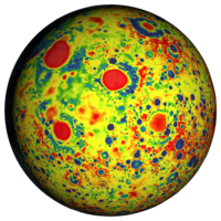
Many gravity field solutions have been archived at the NASA PDS Geosciences node (maps, coefficients, etc.).
A table was created to easily access individual data products.
More detailed description of the various types of data archived for the GSFC GRGM1200A solution is available on the PGDA.
The PGDA also hosts regional maps of lunar gravity obtained through local inversions.
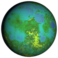
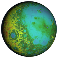
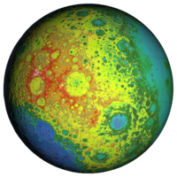
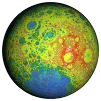
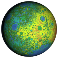
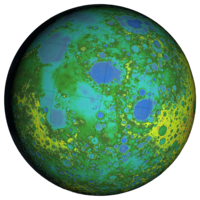
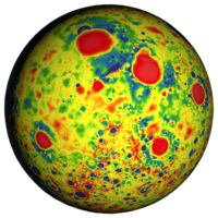
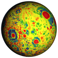
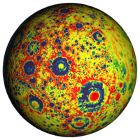
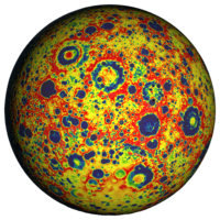
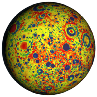
Globe images by the NASA GSFC Scientific Visualization Studio.